
ENGEO has recently performed flood assessments for two clean energy projects – one involving a hydrogen power plant and the other a wind farm.
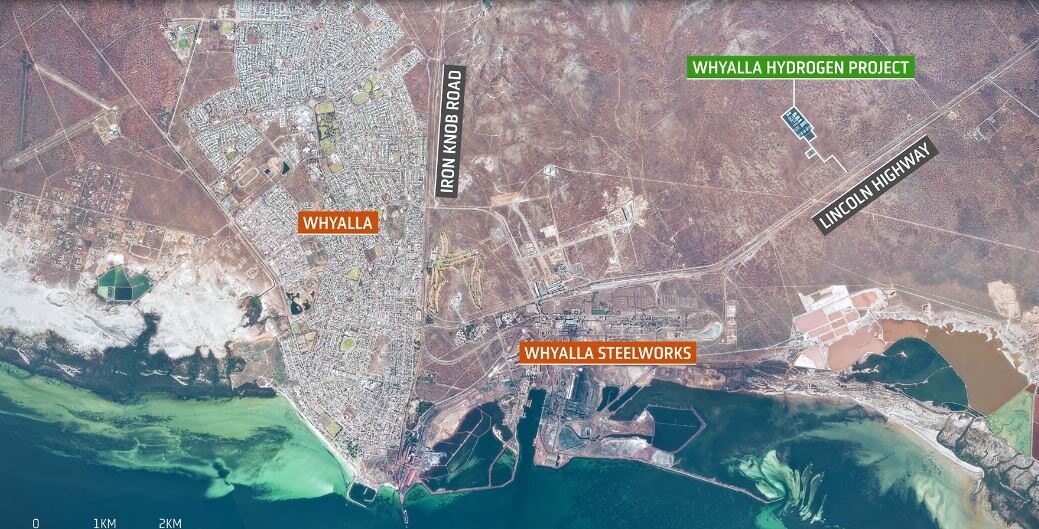
The Hydrogen Jobs Plan is a project for the Government of South Australia involving the construction of a world leading hydrogen power plant, electrolyser, and storage facility. The power plant will be a new source of flexible power, providing additional grid stability for homes and businesses by utilising excess renewable energy generated from large-scale wind and solar farms. ENGEO’s hydrological assessment was used by the project’s planners to help determine where to locate the building footprints of the proposed facilities.
The Carmody Hill Wind Farm project comprises 45 wind turbine generators and two substations. ENGEO’s flood level assessment was used by the project’s civil engineer to determine finished floor levels and design the stormwater conveyance system.
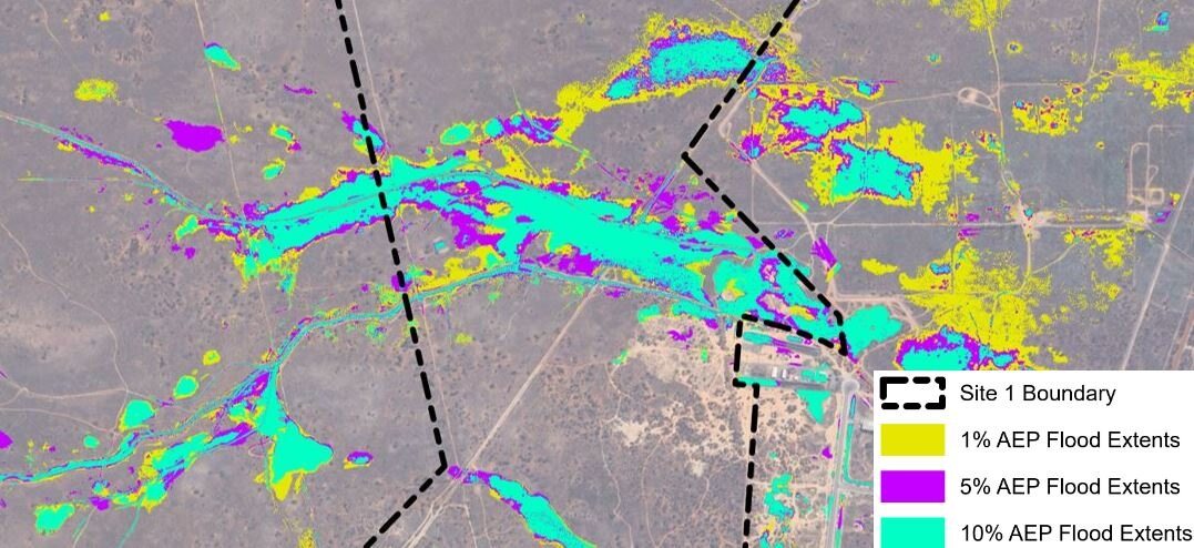
For both projects, ENGEO created rain-on-grid hydraulic models using the HEC-RAS software to characterise each site’s catchment response during 1%, 5%, and 10% annual exceedance probability storm events, incorporating increases in rainfall intensity due to climate change. ENGEO provided estimated flood levels and velocities within the main stream channels adjacent to each site, along with expected peak sheet flow rates that would flow onto the site. Maps showing expected flood extents for each storm event were created to assist with project planning.
Topographic data in the surrounding area was limited to 30-m-resolution satellite data, which is often not adequate for hydraulic modelling. For this project, ENGEO merged the 30-m-resolution satellite data with site-specific 1-m-resolution survey data to create a terrain model that captured the geometry of the stream channels near the sites, while still including the coarser topographic data upstream of the sites.


